external: index
internal: preamble downloads dependencies
usage -> Map Atlas GetMap
old version ubuntu update1 framebuf ... end
Atlas (or Moving Map) continues to grow.
It is great to be flying around in FlightGear, and tracking your path in a moving map
display. It consists of two main applications -
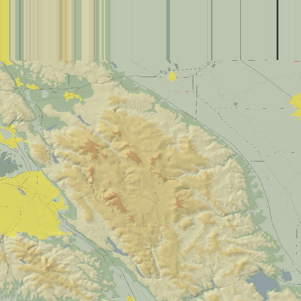
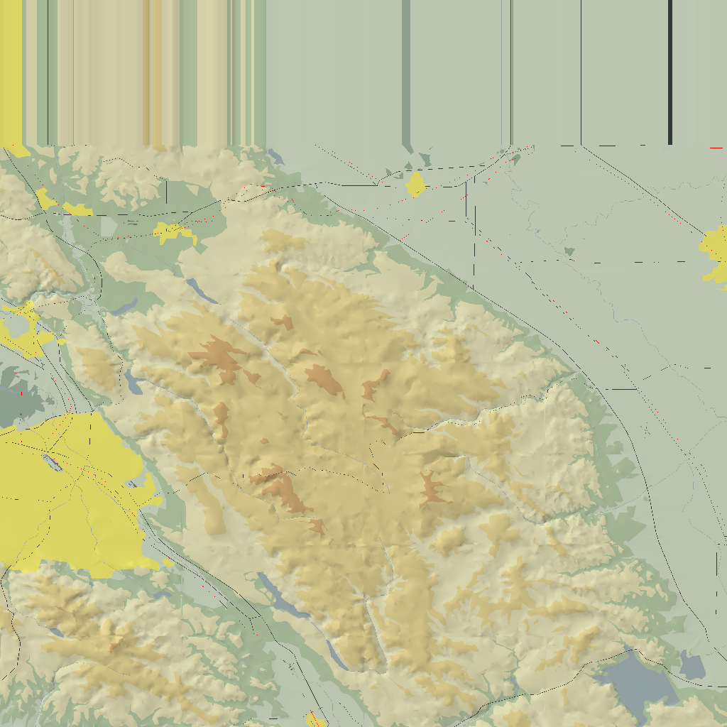
Map - for generating the maps to be displayed in Atlas, and
Atlas - to listen to FlightGear on a udp (say 5500) socket connection, and move the
aircraft over the map, in a PLIB window display.
2011-10-10: ARGH! Forgot to adjust runatlas.bat and atsetup.bat to account for the NEW, very restrictive behavior of Atlas with regards to the location of the 'default.ap' palette file. Now this file MUST be only in FG_ROOT/Atlas/Palettes/ directory. Rather than change all/most of the zips, the 'fixed' batch files are here - atlas-11-bats.zip
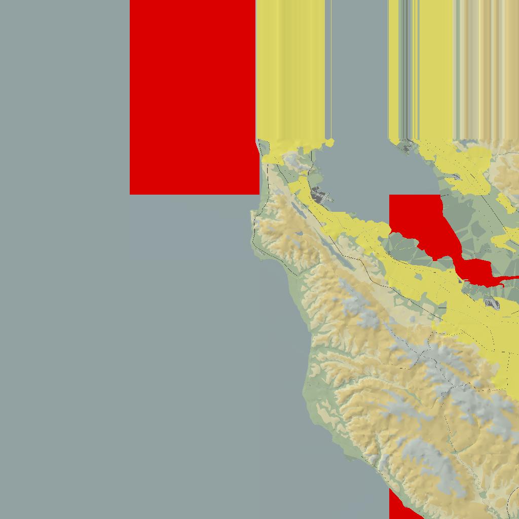
2011-10-09: Update, again in XP using MSVC8. I have set this 'version' to 0.4.9-MSVC8-WIN32, bumping the 'minor' by 1 point, but the zip and other files will have my 'internal' version 11. A NEW dependent library has been introduced, GLew., although I HAD experimented with this over a year ago, with no better results. Unfortunately Map still generates maps with aberrations, blocks of red or gray solid color ;=((
2010-12-04: Update, this time back in XP MSVC8. My version numbering for this project has been getting confusing ;=() Some zip items may indicate version '03', as my 3rd Atlas / Map web release, some may bear version '10', as my 10th build of the Atlas/Map suite in WIN32, and some will be named using the project internal version '0.5.0' that I have used for this build... and then the page title '08'? ... must sort this out some time ;=()
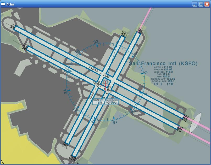
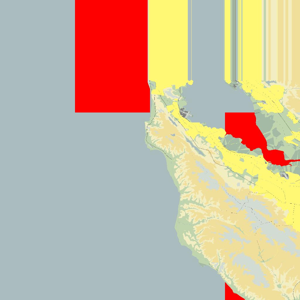
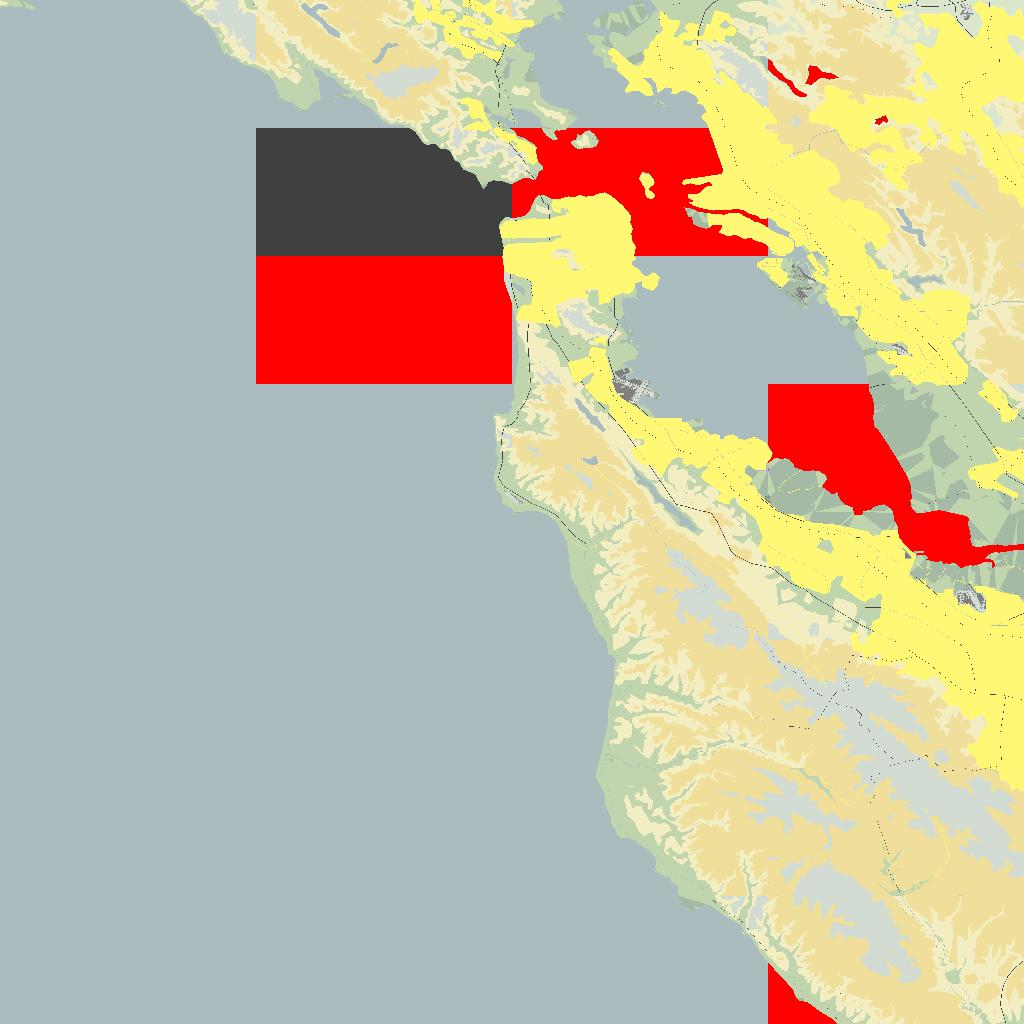
| Stunning airport layout... | Lots of NAVAID details... here water colored red! |
|
|
|
My last WIN32 port was back in May 2010, before that, January, 2009, and before April, 2008, so it seemed time to try it again, this time back in XP, after Vista, still WIN32, back to using MSVC8 (2005), rather than MSVC9 (2008), or later... See page atlas-07a.htm if you want to read the 'interesting' build and fix details.
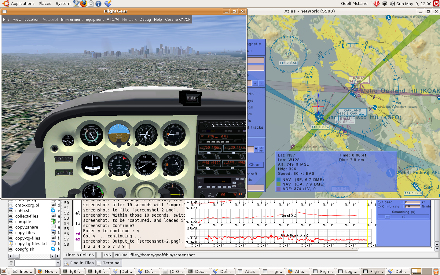
2010-05-14: Here I am, in the default Cessna, headed for SF, with my (wobbly) track shown in Atlas on the right, and my flight details in the graph below. The 'maps' were generated with the Map utility, using the src/data/Palettes/cd-a.ap palette file. Great stuff... Click on image to see full size 1440x900 png file...
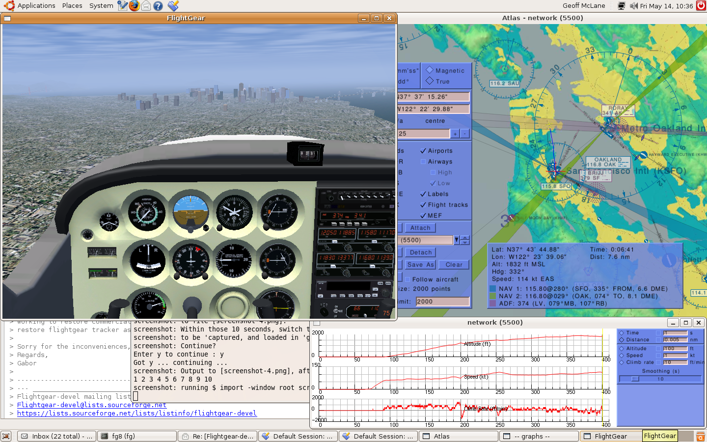
This was actually snapped in Ubuntu 8.04 LTS 64-bits, but I hope to have the same running in native Windows 32-bit soon... (previous bad image - before some important code fixes!).
RUN WEB EXECUTABLES AT YOUR OWN RISK!
2011-10-09: Some downloads:
atlas-11-all.zip: The whole shebang - build file, executables, source and 3rd party
directory, all in one.
atlas-11-sln.zip: The build files. Actually is the whole projects\msvc\
folder, excluding 'bin'.
atlas-11-exe.zip: Just the set of 3 executables, plus the Debug versions.
atlas-11-src.zip: The Atlas/Map source, excluding the 'projects' directory.
atlas-11-3rd.zip: The complete projects\3rdparty folder, with includes and
libraries.
| Date | Link | Size | MD5 |
|---|---|---|---|
| 2011/10/09 | atlas-11-all.zip | 38,425,606 | 6f975e96ef1e98d1932ec07f108e823d |
| 2011/10/09 | atlas-11-exe.zip | 3,292,312 | 427251e5aa35399e9b2dd28101c8272b |
| 2011/10/09 | atlas-11-src.zip | 317,335 | e639e7f4b33026f99364ea3a4b715fde |
| 2011/10/09 | atlas-11-sln.zip | 70,656 | 267036f951fec87a4029f6cf77f829a8 |
| 2011/10/02 | atlas-11-3rd.zip | 34,512,262 | 66adb3b883d42e7a793812ca6508ad7c |
Alternatively, you could download the Atlas CVS source as follows, apply this patch atlas-11-diff.txt. But since the patch does NOT contain entirely NEW files for projects/msvc folder, also overlay it with the atlas-11-sln.zip. And use any dependencies not built by you from atlas-11-3rd.zip.
Atlas Web Page: atlas.sourceforge.net
Atlas CVS Resources : When prompted for the password, just press the Enter key
cvs -d:pserver:anonymous@atlas.cvs.sourceforge.net:/cvsroot/atlas login
cvs -z3 -d:pserver:anonymous@atlas.cvs.sourceforge.net:/cvsroot/atlas co Atlas
NOTE WELL: In this build the FGBASE_DIR is defined as 'C:/FG/29/data'. This will probably NOT match your environment. Either set FG_ROOT=<path/to/your/fgdata>, or ensure you run Map/Atlas with --fg-root=<patth/to/fgdata>!
2011-10-02: A NEW dependency, GLew was added. Here I use release 1.7.0 [08-26-11].
SimGear, zlib, PLIB (fnt, js, net, sg, pui, puAux, ul), freeglut (static), jpeg-8b, libpng, and libcurl (for GetMap), and due to 'SimGear' - boost <http://www.boost.org/> and OSG <http://www.openscenegraph.org/>
In an attempt to keep the full zip size down, the zip only includes a sub-sets of boost and OSG, thus these must either be fill in with any missing includes, say from boost_1_42_0.zip or OSG-2.9.9.zip, or switch the build to look elsewhere for either, or any, of the 3rd party dependencies...
There seems a strong case in separating the SimGear libraries into the set used in linux builds, so that perhaps some of these dependencies, particularly boost and OSG, since in neither case are the binary libraries required, could be reduced.
2010-12-06: As easy as 1, 2, 3 ;=))
1: Grab just atlas-03-exe.zip if you just want to try the WIN32 executables. No source or compiling needed. This contains just Map.exe, Atlas.exe and GetMap.exe...
2: Full Zip: Atlas-0.5.0-src.zip: In this zip, about 32MB, I have included a COMPLETE zip of my work folder. It contains _ALL_ the source, headers, 3rdparty includes and binary libraries, etc, needed to compile Atlas, Map, and GetMap, with any version of MSVC, 8 upwards, hopefully in any windows system. You just download the ZIP, and unzip it into a folder of your choice, start up MSVC, and load up build/msvc/Altas.dsw, and build it ;=)) Should practically work out-of-the-box as they say...
3: Alternatively you could download the current Atlas CVS source, patch this with atlas-0.5.0.diff.txt, add the atlas-10-msvc.zip, and as much of the atlas-10-3part.zip as needed, perhaps dealing with some external dependencies separately... See the build page for details of the 'differences'...
RUN WEB EXECUTABLES AT YOUR OWN RISK!
| Date | Link | Size | MD5 |
|---|---|---|---|
| 06/12/2010 | atlas-03-exe.zip | 638,706 | c78b77a6726204fad3dc902ca80e24c0 |
| 06/12/2010 | Atlas-0.5.0-src.zip | 32,666,693 | a4bc4fcf175c5ff263e39e91cb85beb0 |
| 2010/12/07 | atlas-10-msvc.zip | 5,076,063 | e4055756a30af634b0488fd91f733440 |
| 2010/12/06 | atlas-10-3part.zip | 27,214,584 | 63a35d9b35b45d093ad9b82f0b71c472 |
Atlas Web Page: atlas.sourceforge.net
Atlas CVS Resources : When prompted for the password, just press the Enter key
cvs -d:pserver:anonymous@atlas.cvs.sourceforge.net:/cvsroot/atlas login
cvs -z3 -d:pserver:anonymous@atlas.cvs.sourceforge.net:/cvsroot/atlas co Atlas
Still a number of outstanding items to 'fix' in this WIN32 release before fully viable, but in general works well...
2010-05-19: atlas-09-exe.zip - old WIN32 executables. No source.
Full Zip: atlas-0.4.9.zip: In this zip, about 30MB, I have included a COMPLETE zip of my work folder. It contains _ALL_ the source, headers, 3rdparty libraries, etc, needed to compile Atlas and Map, with any version of MSVC, hopefully in any system. You just download the ZIP, and unzip it into a folder of your choice, start up MSVC, and load up projects/msvc/Altas.dsw, and build it ;=)) Should practically work out-of-the-box as they say...
Advise if you have any problems, and I am sure I can solve it quickly. Some 'boost' headers may be missing, but just download boost_1_42_0.zip, and extract the needed file(s). Then in the same folder, projects/msvc there is a 'runmap.bat' file. If your FG base data is in C:\FG\33\data, then all you need to do is supply an OUTPUT folder name, like say 'test1'.
If your FG base data is elsewhere, which is more probable, then you give that folder as the 2nd parameter to the runmap.bat file, or modify the atsetup.bat file, changing 'C:\FG\33\data' to suit your case. NOTE, if your path contains spaces, then you must user the 'short' names (8.3 format) - use 'dir /X *' to find the 'short' names... Some needed files will be copied to this folder, and Map.exe will be run to generate the maps...
The table below includes this all-in-one zip, and well as sort of incremental zips, depending on what you already have, and what you need more...
RUN WEB EXECUTABLES AT YOUR OWN RISK!
| Date | Link | Size | MD5 |
|---|---|---|---|
| Older versions | |||
| 2010/05/19 | atlas-0.4.9.zip | 28,952,045 | 901f8741f7b67179e7c4edaf536036fe |
| 2010/05/19 | atlas-09-all.zip | 355,190 | 65dac91ae61bb6b02bd4305123d98970 |
| 2010/05/19 | atlas-09-sln.zip | 66,118 | b033ed29113af871f4ed6f06c069eb2e |
| 2010/05/19 | atlas-09-exe.zip | 3,670,410 | 714fb43e40bc505f27c4ca075ac897e7 |
| 2010/05/19 | atlas-09-src.zip | 284,981 | a6d26a4ffa27fc13f8a34e130a1c417e |
| 2010/05/07 | atlas-08-3rd.zip | 26,447,553 | 9d3fa56e2cff24f5bbe65f7c85cfb828 |
If you already have the Atlas source, and want to just patch it, then use the atlas-diff09.patch.txt file. And if you already have all the 3rdparty sources compiled, then you only need the atlas-09-sln.zip. The build files, both dsw/dsp, and sln/vcproj (MSVC9 2008) are set to get ALL the 'includes' and 'libraries' from the ..\3rdparty folder, from atlas-08-3rd.zip, but any other 'external' 3rd party sources can be used by adjusting these build files...
2010-05-19: The reason I need you to download, and build Map.exe is that it is not running correctly in my Windows system, and I do not yet know the cause, but using FlightGear's Simgear GL extension support have achieved a 'reasonable' result ;=().
|

|
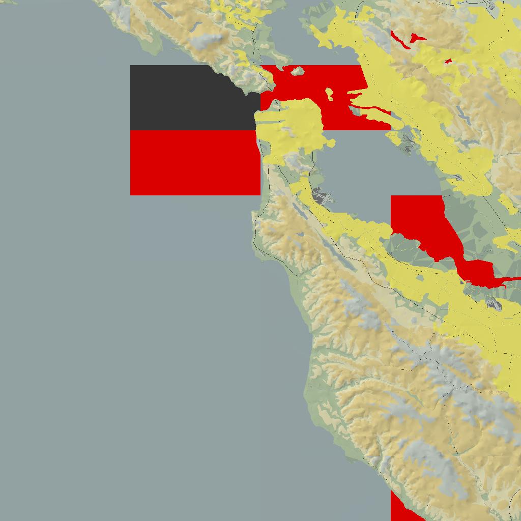
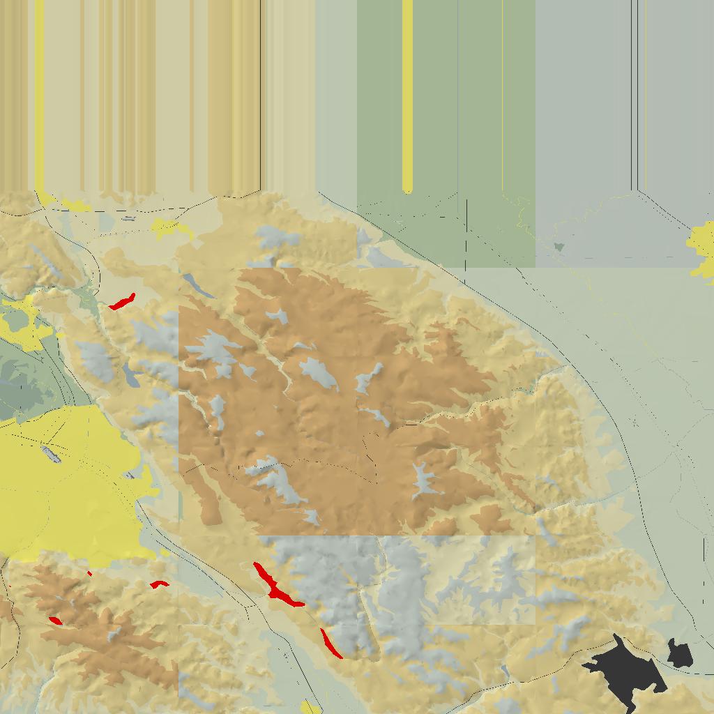
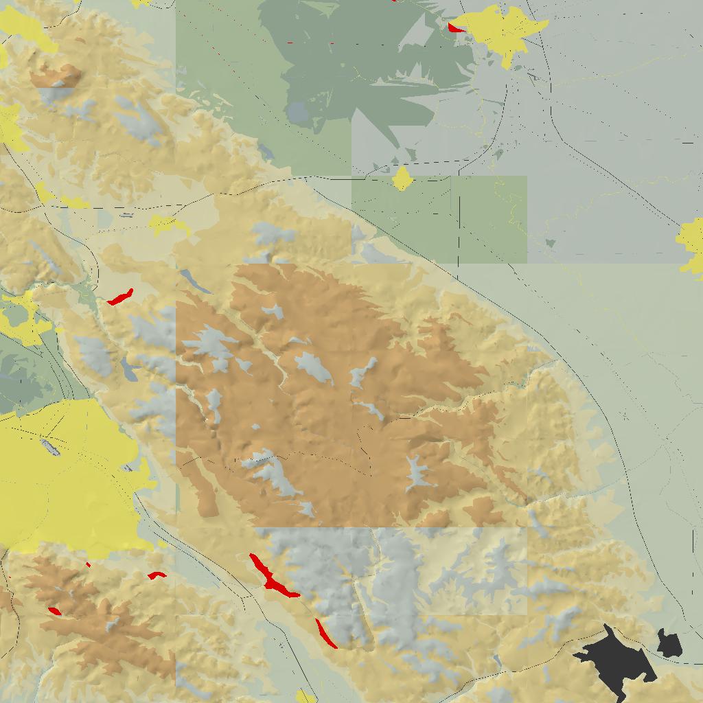
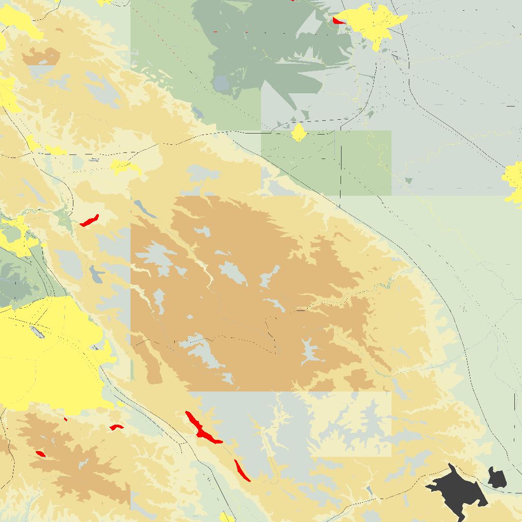
Certainly NOT perfect, but now only with some color aberrations in certain 'buckets'...
2010-04-29: But I just noted there are ALSO some aberrations if I use --render-to-window on my Ubuntu Map build. Click images to load full 1024x1024 image. This is still present as of 2010-05-09...
| As JPEG images (default or --jpg) | As PNG images (--png) | |||
|
|

|
|
|
SO, it is NOT only windows that has a problem with --render-in-window! It is at least partially there in unix!
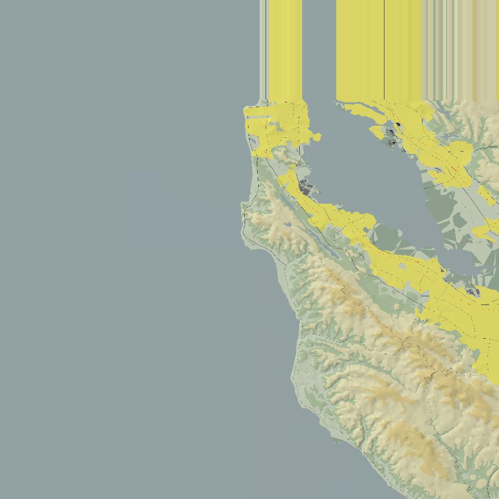
Some recent changes in the CVS source suggested perhaps something had been fixed, but still get a problem ;=(( Images are 'contained' in 128x128 (or 256x256) size, but click on the image to load the full 1024x1024 images.
(a) Release Configuration
As previously indicated, the 'Release' version of Map produces 'blank', gray or gray with black
blobs -
| With lighting (default) | NO lighting | |||

|

|

|

|
|
(b) Debug Configuration
Debug fairs better, but far from perfect -
| With lighting (default) | NO lighting | |||
|
|
|

|
|
With some help from the FlightGear board, and using the built in SimGear supports for the GL extended functions, thanks to Erik and Fred, things are starting to look better. However the Release version completely CRASHED, but that was subsequently fixed. Here are the Debug configuration generated images...
Debug Configuration
Again, this is an 'improvement', of sorts, but still -
| With lighting (default) | NO lighting | |||

|
|
|
|
|
So the 'Render to Buffer' seems a step in the right direction ;=)) But the 'lighting' parameter seems to have no effect, other than changing the over all 'shade' of the images...
| Date | Link | Size | Description | MD5 |
|---|---|---|---|---|
| 2010/05/09 | atlas-0.4.8.zip | 29,004,281 | Complete source. All files and folders, excluding 'bin'. | 1032976aeb26b29ea42b7d0fe247ef39 |
| 2010/05/09 | atlas-08-all.zip | 453,117 | Contains patch file, plus sln, and src zips | 65ee3c37663644d2b735232468d20cd8 |
| 2010/05/09 | atlas-08-sln.zip | 70,866 | All the projects/msvc folder files. | a7850135238b904bb5cc015944f57ec3 |
| 2010/05/09 | atlas-08-exe.zip | 3,663,907 | Release and debug executables | 6dd80893b8aca94424b088def2e1d144 |
| 2010/05/09 | atlas-0.4.8.tar.gz | 485,156 | Source, including projects/msvc folder | 774a9c8570c88940543e4ab3ad672282 |
| 2010/05/09 | atlas-08-src.zip | 378,663 | Source, excluding project/msvc folder | 217564ea53da8dc6624a7f179483d852 |
| 2010/05/07 | atlas-08-3rd.zip | 26,447,553 | Zip of projects/3rdparty folder only. | 17859d0b4dd85d6c913ee4f8e5c4f669 |
If you already have the Atlas source, and want to just patch it, then use the atlas-diff08.patch.txt file. And if you already have all the 3rdparty sources compiled, the you only need the atlas-08-sln.zip. It contains an Atlas-ext.zip, containing MSVC files suitable for using 'external' source, although of course those in the 'sln' zip can also be modified, and are more up-to-date...
| Date | Link | Size | MD5 | |
|---|---|---|---|---|
| Final new update to come Atlas-0.4.8 soonest... | ||||
| 2010-05-08 | atlas-0.4.8a.zip | 28,980,120 | 38926502818972a24c8b4aba997e3c40 | |
| Initial patch to CVS source - atlas-diff08a.patch | ||||
| 2010/04/24 | atlas-07-src.zip | 275,474 | 1bfdc2aa3772aa98e0636b31f3f3e82b | |
| 2010/04/24 | atlas-07-sln.zip | 61,171 | 48d781dab80045b273d9adb807f695ac | |
| 2010/04/24 | atlas-07-exe.zip | 1,958,333 | 2febe8510a717ea43a95e4d2d761c756 | |
| 2010/04/24 | atlas-07-all.zip | 343,825 | 7dc6ecc508678a985f6576c4001a56be | |
| 2010/04/24 | atlas-0.4.7.zip | 28,939,333 | 429c7432f454af45ff8e3893a3546209 | |
Alternatively you could download the Atlas CVS source, patch this with atlas-diff07.patch, add the above atlas-07-sln.zip, and deal with all the external dependencies separately.
Atlas Web Page: atlas.sourceforge.net
Atlas CVS Resources : When prompted for the password, just press the Enter key
cvs -d:pserver:anonymous@atlas.cvs.sourceforge.net:/cvsroot/atlas login
cvs -z3 -d:pserver:anonymous@atlas.cvs.sourceforge.net:/cvsroot/atlas co Atlas
Map: An application to generate jpg or png maps from the flightgear scenery data. In general it searches for the <index>.stg files in the scenery data, and loads the BTG (Binary TerraGear) into a GL context, then writes the image out to either jpg or png files to be loaded and used by Atlas.
Running Map with the --help command will show that parameters that can be added
Map - FlightGear mapping utility

Usage:
  --fg-root=path     Overrides FG_ROOT environment variable
  --fg-scenery=path  Overrides FG_SCENERY environment variable
  --atlas=path       Store maps in path
  --palette=path     Set the palette file to use
  --minmax=<lat,lon,lat,lon> Set min. and max. limits.
  --chunk=<chunk>    Limit mapping to a 10x10 degree chunk.
  --force            Force overwrite of existing images.
  --png              Create PNG images
  --jpeg             Create JPEG images with quality 75 (default)
  --jpeg=integer     Create JPEG images with specified quality
  --aafactor=integer Antialiasing factor (default = 0)
  --render-offscreen Render offscreen (default)
  --render-to-window Render to a window
  --discrete-contour Don't blend contour colours (default)
  --smooth-contour   Blend contour colours
  --no-contour-lines Don't draw contour lines (default)
  --contour-lines    Draw contour lines
  --light=azim,elev  Set light position (default = <315, 55>)
  --lighting         Light the terrain (default)
  --no-lighting      Don't light the terrain (flat light)
  --smooth-shading   Smooth polygons (default)
  --flat-shading     Don't smooth polygons
  --test             Do nothing, but report what Map would do
  --verbose          Display extra information while mapping
  --version          Print version and exit
  --help             Print this message
The --fg-root=<path> is the same as that for running fgfs. It points to the base FG data. The --fg-scenery=<path> points to the scenery you want to generate maps for. The --atlas=<path> is the output path where the generated maps will be stored. The --palette=<file> give the color palette file to use which maps elevations to a color, and a number of materials to a color. The --test parameter allows you to preview what Map is about to process.
Atlas: An application to read and display the maps generated by the Map application, plus a lot more ;=)) It can 'listen' on an IP:port number for data output by the running 'fgfs' application, giving the changing location of the aircraft. And it will track the aircrafts movement on the maps displayed. Further the maps displayed are overlaid with navigation data, and when zoomed in will draw the runways to scale.
The --help command will output a set of commands that can be passed to Atlas
ATLAS - A map browsing utility for FlightGear

Usage:

Atlas <options> [<flight file>] ...

   --fg-root=<path>    Overrides FG_ROOT environment variable
                       Default: C:/FG/29/data
   --fg-scenery=<path> Overrides FG_SCENERY environment variable
                       Default: C:/FG/29/data/Scenery
   --atlas=<path>      Set path for map images
                       Default: C:/FG/29/data/Atlas
   --palette=<palette> Specify Atlas palette file (.ap), in the above
                       <path>/Palettes/ directory
                       Default: default.ap
   --lat=<x>           Start browsing at latitude x (south is negative)
                       Default: 37.50
   --lon=<x>           Start browsing at longitude x (west is negative)
                       Default -122.25
   --airport=<str>     Start browsing at an airport specified by ICAO code
                       or airport name
   --zoom=<x>          Set zoom level to x metres/pixel
                       Default 125.00
   --glutfonts         Use GLUT bitmap fonts (fast for software rendering)
   --geometry=<w>x<h>  Set initial window size
                       Default: 800x600
   --softcursor        Draw mouse cursor using OpenGL (for fullscreen Voodoo
                       cards)
   --udp[=<port>]      Input read from UDP socket at specified port
                       Default: 5500
   --serial[=<dev>]    Input read from serial port with specified device
                       Default: /dev/ttyS0
   --baud=<rate>       Set serial port baud rate
                       Default: 4800
   --max-track=<x>     Maximum number of points to record while tracking a
                       flight (0 = unlimited)
                       Default: 0
   --update=<s>        Check for position updates every s seconds
                       Default: 1.00
   --autocenter-mode   Automatically center map on aircraft
                       Default: false
   --line-width=<w>    Set line width of flight track overlays (in pixels)
                       Default: 1.00
   --airplane=<path>   Specify image to be used as airplane symbol in flight
                       tracks.  If not present, a default image is used.
   --airplane-size=<x> Set the size of the airplane image in pixels
                       Default: 25.00
   --discrete-contours Don't blend contour colours on live maps (default)
   --smooth-contours   Blend contour colours on live maps
   --contour-lines     Draw contour lines at contour boundaries
   --no-contour-lines  Don't draw contour lines at contour boundaries (default)
   --lighting          Light the terrain on live maps (default)
   --no-lighting       Don't light the terrain on live maps (ie, flat light)
   --smooth-shading    Smooth polygons on live maps (default)
   --flat-shading      Don't smooth polygons on live maps
   --light=azim,elev   Set light position for live maps (all units in degrees)
                       Azimuth is light direction (0 = north, 90 = east, ...)
                       Elevation is height above horizon (90 = overhead)
                       Default: 315.0,55.0
   --version           Print version number
   --help              Print this help
NOTE WELL: In this build the FGBASE_DIR is defined as 'C:/FG/29/data'. This will probably NOT match your environment. Either set FG_ROOT=<path/to/your/fgdata>, or ensure you run Map/Atlas with --fg-root=<patth/to/fgdata>!
GetMap: This is an alternative way to obtain 'map' images to be displayed by Atlas. It uses the 'curl' library to fetch map images for Web Map Servers (WMS).
The usual --help
GetMap - FlightGear mapping retrieval utility
Version: 0.4.9-MSVC8-WIN32 compiled Oct  8 2011 at 18:52:10
Usage:
  --size=pixels   Create map of size pixels*pixels (default 256)
  --base-url=url  Beginning of the url of the WMS server
  --atlas=path    Create maps of all scenery, and store them in path
  --min-lat       Minimum latitude
  --max-lat       Maximum latitude
  --min-lon       Minimum longitude
  --max-lon       Maximum longitude
  --verbose       Display information during processing
  --asis          Use the base URL as given, without modification.
  and this means no min. or max. latitude and longitude need be given.
  The data downloaded in this case will be written to '<path>/tempimg'
It presently seems quite difficult to find 'public' WMS servers. The default server given in
the source seems to no longer offer full WMS services. I would certainly appreciate hearing
from any one having a working URL - send an email to ![]() . Thanks...
. Thanks...
EOP - atlas-07.htm - 2011-10-08 - 2010-12-09:2010-05-19:2010-05-08:2010-04-24