travel gilgandra
local: google vmap0 osm josm here info why end
As part of the trip, while in Gilgandra, I had to drive out the Bearbong Road, out to the properties where I spent some of my youth. Over the roads that my school bus travelled, collecting all the kids around the district. I live about a mile from the bus stop, and got there using an old 1946 Chev my father let me use, sometimes picking up Elita and Albi on the way. We were joined by the Hobson kids, also arriving in a 1936 Chev (I think). One interesting pickup, before the bus changed its route to use the Back Creek Road, was the Buckley kids who arrive in a horse and sulky, and had a nice coral for the horse during the day. Wow, what a time that was.
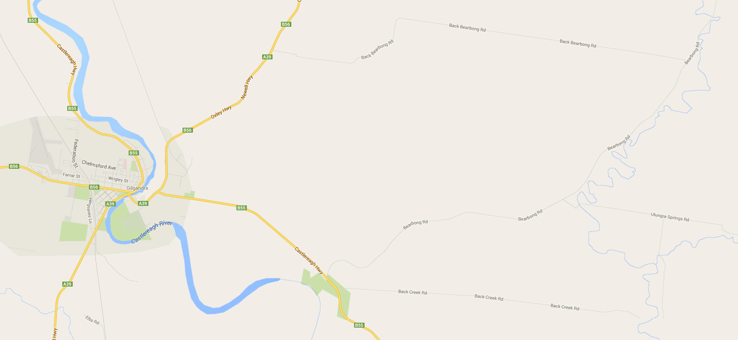
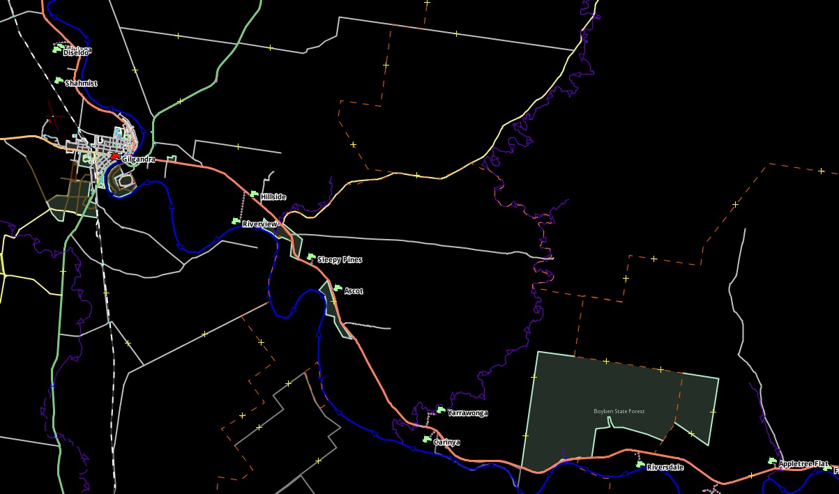
20140621: More recently I searched for the road in the online mapping services. For sure it is certainly visible in Google Maps - Here constrained to 1020x687. Click on image to see at full size 1492x687 image in a new window. This display was in a browser.
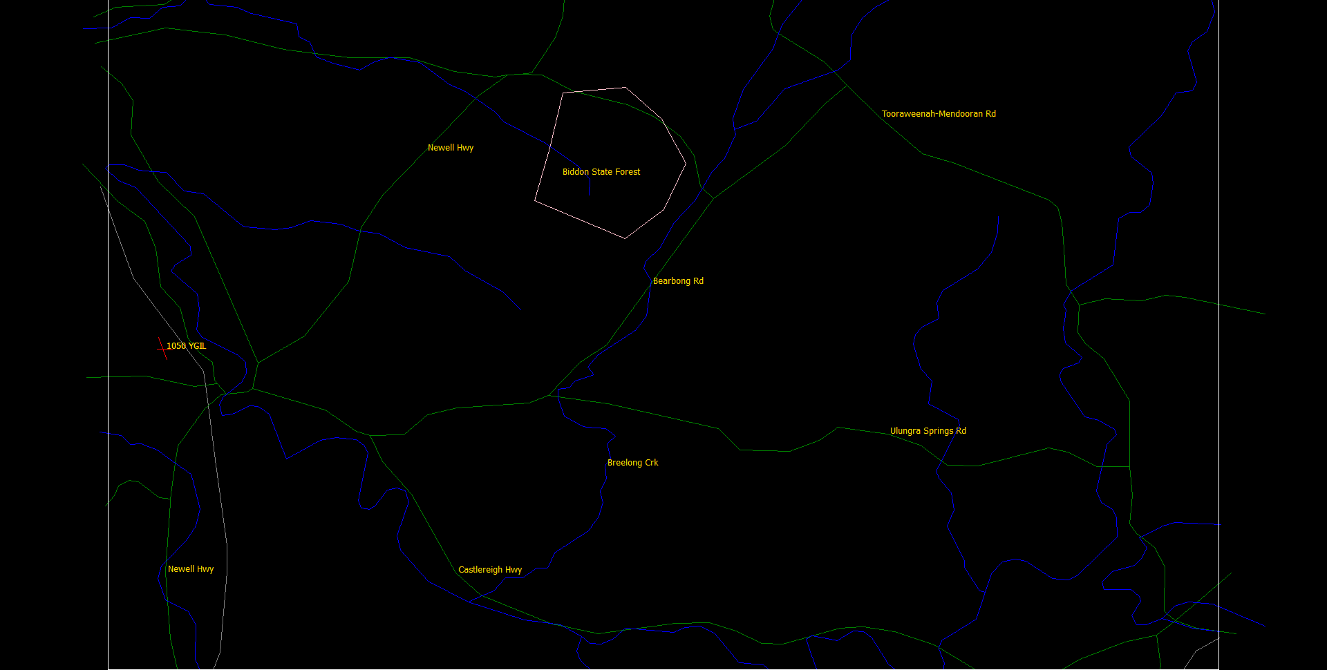
An extract of the road, river, rails and forest data from VMAP0 to a xgraph formatted file, and displayed by Qt polyView2D. Again we can see the Bearbong Road. Click to see the full 1920x970 in a new window. It is quite a long roads from where it branches from the Castlereigh Hwy, beside the Boyden State Forest, just before the Back Creek Rd turnoff (not shown in this view), all the way to the Tooraweenah(-Mendooran) Rd, near the Dilly State Forest. If I remember correctly it is paved for about 2/3 of its length, until about the Flora Reserve Rd turnoff. The other important road shown in this view is the Ulungra Springs Rd, off to the right, crossing the Breelong Creek, headed off to Apple Tree Flats, and also onwards to also meet the Tooraweenah Rd.
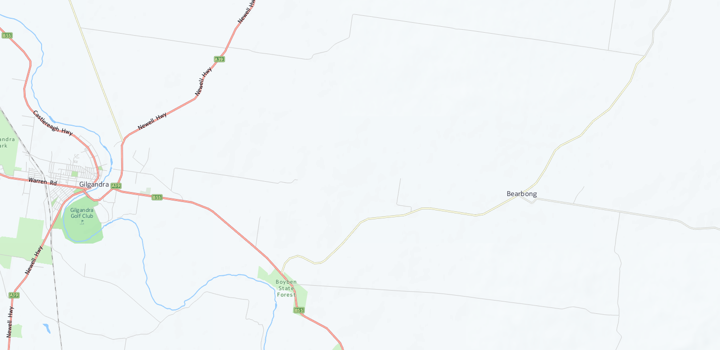
20160716: The Bearbong, and Back Creek Road, plus have now been added - See Bearbong OSM2... Great!
20140627: Was strangely absolutely MISSING from OpenStreetMap (OSM) at this time. Likewise also shown at full 1031x520 size. This display is in a browser, using my map-test.html for the image.
20160716: Using JOSM, downloaded a ygil3.osm, and this is the JOSM display. Here constrained to a 1020x500 display. Click on the image to see the full 1203x709 in a new window.
20140627: Previously, again using JOSM, downloaded a ygil.osm, and this is the JOSM display. Here constrained to a 1020x500 display. Click on the image to see the full 1525x898 in a new window. Has a big black hole where Beabong should be!
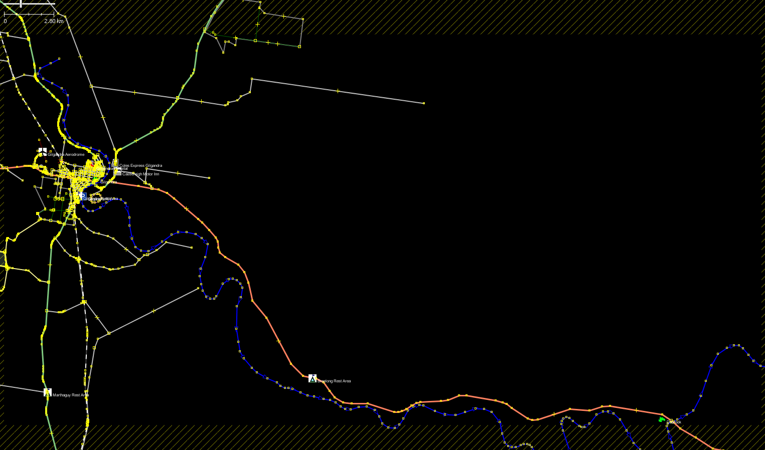
The bbox for the above JOSM images is min lat: -31.8541708, max lat: -31.6189502, min lon: 148.6104662, max lon: 149.062721.
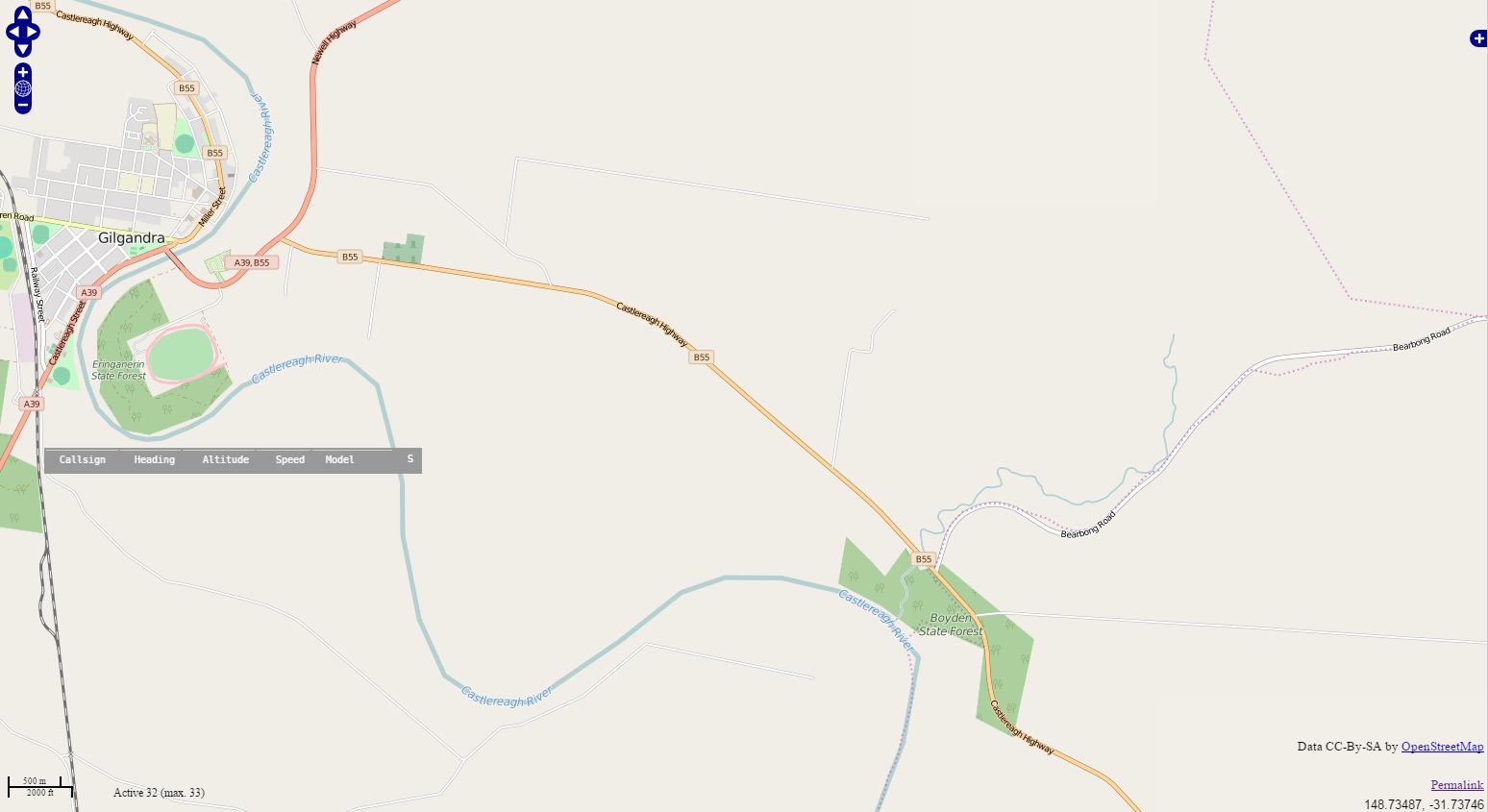
20140710: Came across another 'map' service from here.com, a Nokia company, and of course it also shows the Bearbong Road. Image is constrained to 1020x495. Click on map to see full 1455x707 in a new window. For some reason they choose to not include the Breelong Creek, and other creeks in this map. And this is similar to the Bing maps, probably since I think Microsoft and Nokia 'share' data for these maps.
The reason this is so important to me is that the new generation of FlightGear v2.12 scenery only uses OSM, and some other raw data source, but NOT VAMP0 (I think) and thus the Bearbong Road is MISSING. It is available in the old previous scenery generation 1.0.1, which was based on VMAP0! Why can it not also be in 2.12?
This site has good information about the Breelong Creek - http://www.bonzle.com/ - It advises the Breelong Creek starts at an elevation of 390m and ends at an elevation of 304m flowing into the Castlereagh River. The Breelong Creek drops around 85.8m over its 50.7km length. The following creeks flow into the Breelong Creek: Uargon Creek and Wallumburrawang Creek.